What Are The Uses Of Drone Surveying?
Drone surveying is the latest technology used for land mapping. It is advantageous in many ways and it has benefits for everyone from city planners to security managers. Everyone needs a bird’s eye view of the development work because it is all-inclusive. You can see a vast area in one frame without scrolling the image up and down.
Let’s understand the advantages of using drones for mapping
1. City planning
City planning becomes easy when you have complete data on the land where a city is planned. If you can see the piece of land from above, you can view everything from green areas to dry areas. You can identify natural resources and plan the development in such a way that it causes minimum damage to the environment.
2. Construction management
Aerial scanning has made it easier to manage construction work. For example, you can see how the construction material is scattered on the site. You can even monitor the quantity of construction material consumed and wasted. Also, you can easily locate a safe place for landing your construction material. Drone mapping can help save expensive materials from waste.
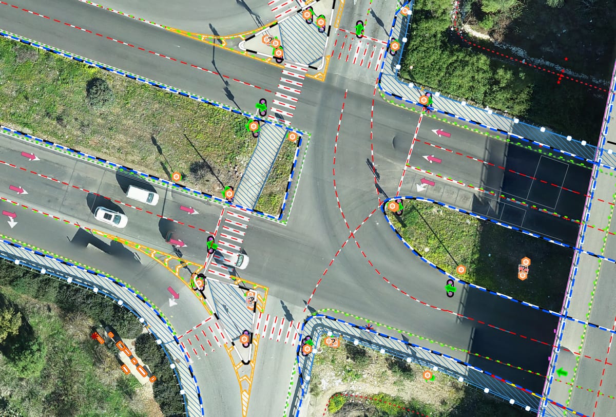
3. Traffic management
The aerial view of a city can give you an insight into how the traffic is moving in a city. If the traffic is slow, you can locate the bottlenecks and find ways to release the traffic and improve the flow. Aerial surveys will save you time as drones can be flown at any time to monitor traffic movement.
4. Security system
The biggest advantage of drone mapping is it can help in beefing up the security system of smart cities. A bird’s eye view of a city can show loopholes and gaps in security. It will provide you ample time to beef up your security system before the unsocial elements take advantage of the security failure.
5. Comparison
Aerial pictures of a developing site can be preserved to compare the development work completed in a given time. The images will show how the area developed and whether the development is sustainable. The images can be used for regulatory compliance and insurance.
Drone surveying has revolutionized the way maps are made. For example, you can make a digital model of a development project and see whether the development is carried out according to the rules. Also, you can foresee the impact of a development project on the environment.


Comments
Post a Comment